East Road
Introduction
The photograph on this page of East Road by Ian Capper as part of the Geograph project.
The Geograph project started in 2005 with the aim of publishing, organising and preserving representative images for every square kilometre of Great Britain, Ireland and the Isle of Man.

There are currently over 7.5m images from over 14,400 individuals and you can help contribute to the project by visiting https://www.geograph.org.uk
East Road
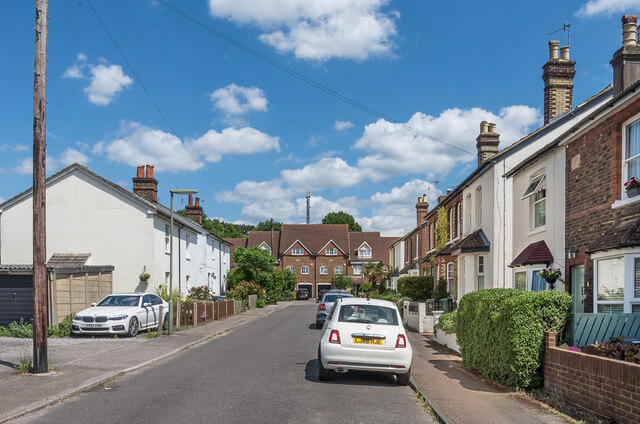
Image: © Ian Capper Taken: 25 May 2020
Victorian cottages (the nearest one on the right has a date plaque of 1883) in East Road. Old maps give the road other names: Gashouse Road on the 1871 1:2,500 map and Gasworks Road on the 1896 edition, both names referring to the town gasworks at its end. The current name first appears on the 1935 edition. Although the gasholders went in the 1960/70s, the site remained the local depot for British Gas until the 1990s, when it was redeveloped for housing (as seen in the background). However East Road itself has retained its Victorian character.
Images are licensed for reuse under creativecommons.org/licenses/by-sa/2.0
Image Location
Latitude
51.241935
Longitude
-0.21119