South Riccalton from the air
Introduction
The photograph on this page of South Riccalton from the air by Thomas Nugent as part of the Geograph project.
The Geograph project started in 2005 with the aim of publishing, organising and preserving representative images for every square kilometre of Great Britain, Ireland and the Isle of Man.

There are currently over 7.5m images from over 14,400 individuals and you can help contribute to the project by visiting https://www.geograph.org.uk
South Riccalton from the air
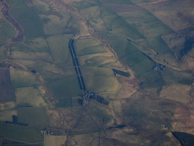
Image: © Thomas Nugent Taken: 7 Feb 2020
The distinctive tree lined avenue leads north east away from South Riccalton Farm. The remains of Stony Law Fort https://canmore.org.uk/site/58149/stoney-law are just discernible in the centre foreground.
Images are licensed for reuse under creativecommons.org/licenses/by-sa/2.0
Image Location
Latitude
55.396727
Longitude
-2.419944