Benchmark on gatepost of No. 25 The Green
Introduction
The photograph on this page of Benchmark on gatepost of No. 25 The Green by Luke Shaw as part of the Geograph project.
The Geograph project started in 2005 with the aim of publishing, organising and preserving representative images for every square kilometre of Great Britain, Ireland and the Isle of Man.

There are currently over 7.5m images from over 14,400 individuals and you can help contribute to the project by visiting https://www.geograph.org.uk
Benchmark on gatepost of No. 25 The Green
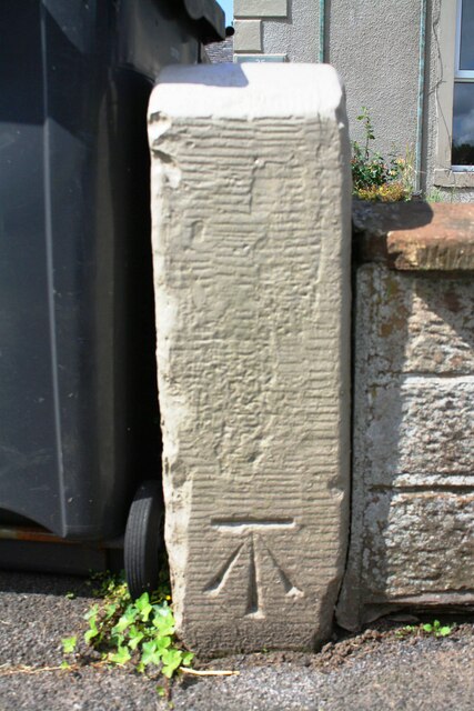
Image: © Luke Shaw Taken: 8 Aug 2019
Ordnance Survey cut mark benchmark described on the Bench Mark Database at www.bench-marks.org.uk/bm112299. It seems possible that the gatepost now in position is the top half of the original post - other posts along the wall Image are taller and the Ordnance Survey description gives the mark as being 80cm above ground
Images are licensed for reuse under creativecommons.org/licenses/by-sa/2.0
Image Location


Leaflet Map data © OpenStreetMap
Latitude
54.837674
Longitude
-2.984284