View from New Whinny Hill
Introduction
The photograph on this page of View from New Whinny Hill by Ian Dodds as part of the Geograph project.
The Geograph project started in 2005 with the aim of publishing, organising and preserving representative images for every square kilometre of Great Britain, Ireland and the Isle of Man.

There are currently over 7.5m images from over 14,400 individuals and you can help contribute to the project by visiting https://www.geograph.org.uk
View from New Whinny Hill
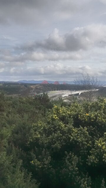
Image: © Ian Dodds Taken: 13 Mar 2021
If you go by the maps the only hill that could be Whinny Hill is here - it is a noticeable bump on the Southern slope of Castlandhill. It is shown to the right of here on paper maps, on a slope of this hill. When you zoom in online Whinny Hill is actually in the middle of the motorway! So it seems likely that there may have been a more pronounced bump, not quite as high as from where this picture has been taken from, but maybe more eye-catching, to the East of here. But since the name still exists I have decided that this is the undisputable New Whinny Hill. If the powers that be want to drop the word New in years to come that's fine by me! The name has nothing to do with horses neighing. It stems from whinstone quarrying in the area.
Images are licensed for reuse under creativecommons.org/licenses/by-sa/2.0
Image Location
Latitude
56.024594
Longitude
-3.413473