Countryside around Sourton
Introduction
The photograph on this page of Countryside around Sourton by Jonathan Billinger as part of the Geograph project.
The Geograph project started in 2005 with the aim of publishing, organising and preserving representative images for every square kilometre of Great Britain, Ireland and the Isle of Man.

There are currently over 7.5m images from over 14,400 individuals and you can help contribute to the project by visiting https://www.geograph.org.uk
Countryside around Sourton
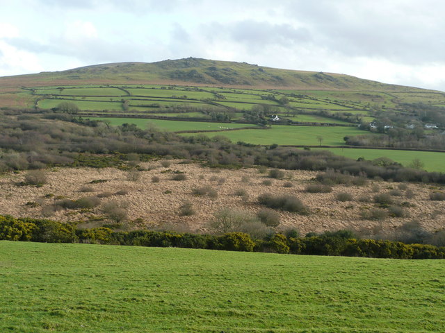
Image: © Jonathan Billinger Taken: 4 Feb 2008
The field in the foreground is within the grid square. Beyond is a tongue of the Prewley Moor, and above this is more pastoral land around Sourton village. The hill dominating the scene is Sourton Tors. The A386 traverses imperceptibly across the image at the level of the houses.
Images are licensed for reuse under creativecommons.org/licenses/by-sa/2.0
Image Location
Latitude
50.700313
Longitude
-4.07614