
Rosyth Community Church, Torridon Lane, Rosyth
Introduction
The photograph on this page of Rosyth Community Church, Torridon Lane, Rosyth by Ian Dodds as part of the Geograph project.
The Geograph project started in 2005 with the aim of publishing, organising and preserving representative images for every square kilometre of Great Britain, Ireland and the Isle of Man.

There are currently over 7.5m images from over 14,400 individuals and you can help contribute to the project by visiting https://www.geograph.org.uk
Rosyth Community Church, Torridon Lane, Rosyth
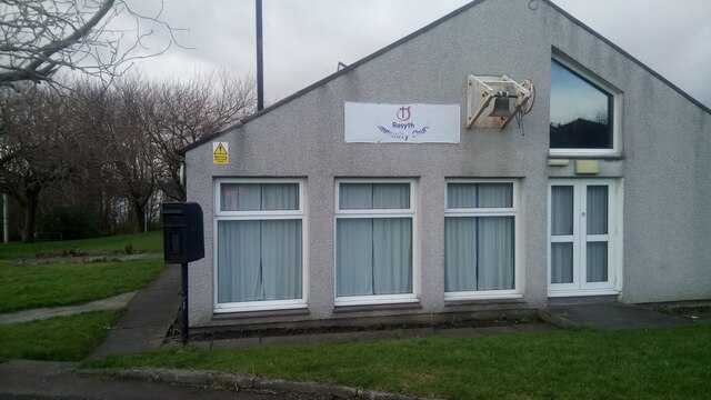
Image: © Ian Dodds Taken: 13 Mar 2021
The church names in Rosyth are quite confusing. This is marked on maps as the Church of St Columba, and there is also another church nearby called the Church of St John and St Columba, so perhaps a merger took place. From looking online it appears to have had other names in the past too - maybe denominations move from building to building depending on the size of their congregations and bank balances?! Two things caught my eye here. Firstly, the bell is on the outside of the church. This building is, at the most, 50 years old, so this could be the way they make them these days - with an increasingly unreligious population steeples up to the heavens are likely a thing of the past I suppose. Secondly, there is a black out-of-service postbox. This must be to either alert people to the fact that it is no longer in use, or to show solidarity with the Black Lives Matter movement, which has made a big impact over the last year or so, as a handful of in-service postboxes were painted black for this reason last year.
Images are licensed for reuse under creativecommons.org/licenses/by-sa/2.0
Image Location

Latitude
56.028002
Longitude
-3.429644