Signpost, Great Corby
Introduction
The photograph on this page of Signpost, Great Corby by Adrian Taylor as part of the Geograph project.
The Geograph project started in 2005 with the aim of publishing, organising and preserving representative images for every square kilometre of Great Britain, Ireland and the Isle of Man.

There are currently over 7.5m images from over 14,400 individuals and you can help contribute to the project by visiting https://www.geograph.org.uk
Signpost, Great Corby
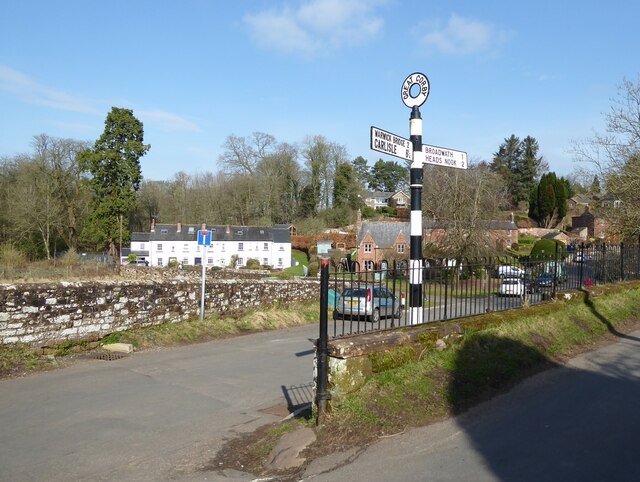
Image: © Adrian Taylor Taken: 7 Mar 2021
A traditional Cumberland County Council signpost at the junction of Sandy Lane and Clints Road in Great Corby. The signpost originally had a third arm directing to Burnrigg which was removed when Sandy Lane Level Crossing at Image was permanently closed to motor vehicles. There was an Ordnance Survey pivot benchmark on the end of the wall; it is no longer visible.
Images are licensed for reuse under creativecommons.org/licenses/by-sa/2.0
Image Location
Latitude
54.883186
Longitude
-2.820726