Reigate Grammar School
Introduction
The photograph on this page of Reigate Grammar School by Ian Capper as part of the Geograph project.
The Geograph project started in 2005 with the aim of publishing, organising and preserving representative images for every square kilometre of Great Britain, Ireland and the Isle of Man.

There are currently over 7.5m images from over 14,400 individuals and you can help contribute to the project by visiting https://www.geograph.org.uk
Reigate Grammar School
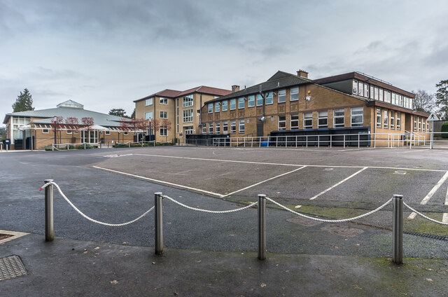
Image: © Ian Capper Taken: 18 Jan 2021
Three Reigate Grammar School buildings - on the left the Peter Masefield Hall (named after a former chair of governors of the school), in the centre the Ballance Building (opened in 2011 and named after Howard Ballance who was headmaster of the school from 1968 to 1982) and on the right the Science Block.
Images are licensed for reuse under creativecommons.org/licenses/by-sa/2.0
Image Location
Latitude
51.236442
Longitude
-0.193196