Underbank Hall Blue Plaque
Introduction
The photograph on this page of Underbank Hall Blue Plaque by Gerald England as part of the Geograph project.
The Geograph project started in 2005 with the aim of publishing, organising and preserving representative images for every square kilometre of Great Britain, Ireland and the Isle of Man.

There are currently over 7.5m images from over 14,400 individuals and you can help contribute to the project by visiting https://www.geograph.org.uk
Underbank Hall Blue Plaque
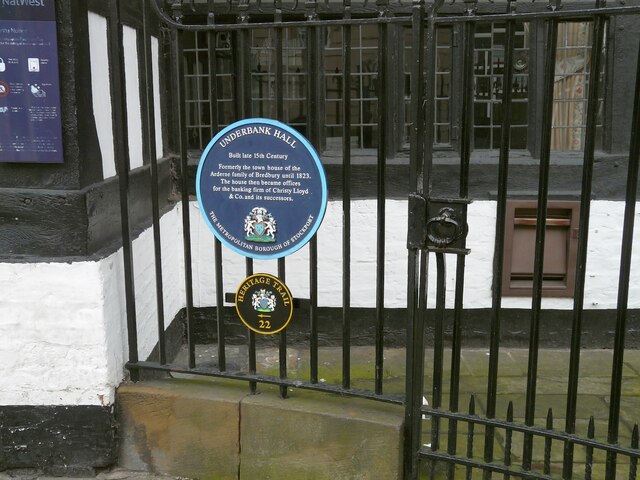
Image: © Gerald England Taken: 8 Dec 2009
The blue plaque on Underbank Hall Image reads: UNDERBANK HALL Built late 15th Century Formerly the town house of the Arderne family of Bredbury until 1823. The house then became offices for the banking firm of Christy Lloyd & Co. and its successors. THE METROPOLITAN BOROUGH OF STOCKPORT It is #22 on the Stockport Heritage Trail.
Images are licensed for reuse under creativecommons.org/licenses/by-sa/2.0
Image Location
Latitude
53.411566
Longitude
-2.158222