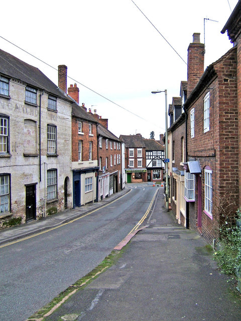
Welch Gate (lower end)
Introduction
The photograph on this page of Welch Gate (lower end) by P L Chadwick as part of the Geograph project.
The Geograph project started in 2005 with the aim of publishing, organising and preserving representative images for every square kilometre of Great Britain, Ireland and the Isle of Man.
There are currently over 7.5m images from over 14,400 individuals and you can help contribute to the project by visiting https://www.geograph.org.uk

Image: © P L Chadwick Taken: 3 Feb 2008
Welch Gate is a very old and winding road which climbs steeply from Bewdley's town centre to the point where it joins the road known as Winbrook. Welch Gate gets its name from the old tollgate which once stood on the route from Wales. This view is looking towards the town centre. The building on the left has what appears to be a bricked in window, which may have been done possibly in the 18th century when many windows were removed to avoid the "window tax" introduced in 1696 and not removed until early Victorian times.

