Old guidestone
Introduction
The photograph on this page of Old guidestone by Chris Minto as part of the Geograph project.
The Geograph project started in 2005 with the aim of publishing, organising and preserving representative images for every square kilometre of Great Britain, Ireland and the Isle of Man.

There are currently over 7.5m images from over 14,400 individuals and you can help contribute to the project by visiting https://www.geograph.org.uk
Old guidestone
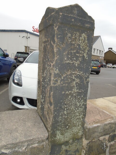
Image: © Chris Minto Taken: 7 Mar 2021
In the wall surrounding Sainsbury's supermarket on the A640, New Hey Road, at Salendine Nook is this distinctive old guidestone pointing the way to Lindley and Lockwood. It has weathered during the last few years and the inscription is not as clear as it was. There is a bench mark near the top of the left-hand side. It may date from the late 18th century.
Images are licensed for reuse under creativecommons.org/licenses/by-sa/2.0
Image Location
Latitude
53.656682
Longitude
-1.843811