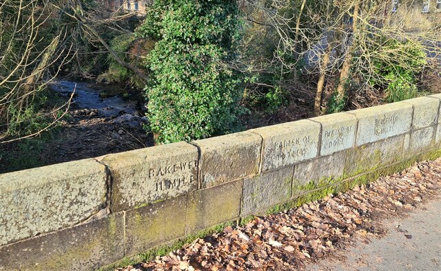
Border bridge, Dore and Totley
Introduction
The photograph on this page of Border bridge, Dore and Totley by Chris Morgan as part of the Geograph project.
The Geograph project started in 2005 with the aim of publishing, organising and preserving representative images for every square kilometre of Great Britain, Ireland and the Isle of Man.
There are currently over 7.5m images from over 14,400 individuals and you can help contribute to the project by visiting https://www.geograph.org.uk

Image: © Chris Morgan Taken: 27 Feb 2021
The Old Hay Brook marks the boundary between Totley parish to the south and Dore parish to the north. Both parishes were originally parts of Dronfield parish in Derbyshire only coming into Sheffield and Yorkshire in 1934. These stones also record 11 miles to Bakewell and 5 miles to Sheffield. At most times of the day it is almost impossible to pick out the outlines of the letters cut into the stone. .

