North Woodside Flint Mill
Introduction
The photograph on this page of North Woodside Flint Mill by Richard Keltie as part of the Geograph project.
The Geograph project started in 2005 with the aim of publishing, organising and preserving representative images for every square kilometre of Great Britain, Ireland and the Isle of Man.

There are currently over 7.5m images from over 14,400 individuals and you can help contribute to the project by visiting https://www.geograph.org.uk
North Woodside Flint Mill
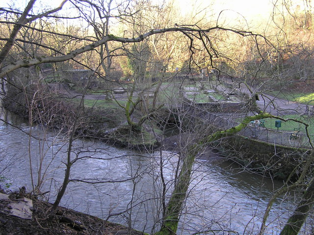
Image: © Richard Keltie Taken: 27 Jan 2005
The remains of the old North Woodside Flint Mill, Garriochmill Road, on the banks of the River Kelvin. It is one of Glasgow's Scheduled Ancient Monuments, the first reference to it being on a map in 1650 when it was shown as a barley mill. At the time of the Napoleonic Wars, at the start of the 19th century, it was used to grind gunpowder. In 1846 it was bought by Robert Cochran, of Verreville Flint Crystal Glass and Pottery Works in Finnieston, who demolished the old barley mill and built the North Woodside Flint Mill, which processed flint and Cornish stone used by Verreville. The mill closed about 1955 and much of it was demolished around 1964. The large square-shaped feature on the left of the site is the remains of the old kiln, close by to the right of which are several large round stones - old grinding stones made from Ballachulish stone.
Images are licensed for reuse under creativecommons.org/licenses/by-sa/2.0
Image Location
Latitude
55.877955
Longitude
-4.280987