Wigton Windmill from Station Road
Introduction
The photograph on this page of Wigton Windmill from Station Road by Roger Templeman as part of the Geograph project.
The Geograph project started in 2005 with the aim of publishing, organising and preserving representative images for every square kilometre of Great Britain, Ireland and the Isle of Man.

There are currently over 7.5m images from over 14,400 individuals and you can help contribute to the project by visiting https://www.geograph.org.uk
Wigton Windmill from Station Road
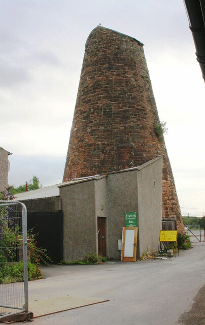
Image: © Roger Templeman Taken: 26 Jul 2019
Ordnance Survey records describe a benchmark which may have been on this building as: 'Wigton Windmill. Bolt in South side ; 4.86 ft. above surface'. The mark was levelled at 71.026 feet above Liverpool Datum in 1844 during the Kendal to Carlisle Survey. Access was not possible at the time of the visit.
Images are licensed for reuse under creativecommons.org/licenses/by-sa/2.0
Image Location
Latitude
54.828993
Longitude
-3.163094