Hope House, 47 Percy Gardens, Tynemouth
Introduction
The photograph on this page of Hope House, 47 Percy Gardens, Tynemouth by Geoff Holland as part of the Geograph project.
The Geograph project started in 2005 with the aim of publishing, organising and preserving representative images for every square kilometre of Great Britain, Ireland and the Isle of Man.

There are currently over 7.5m images from over 14,400 individuals and you can help contribute to the project by visiting https://www.geograph.org.uk
Hope House, 47 Percy Gardens, Tynemouth
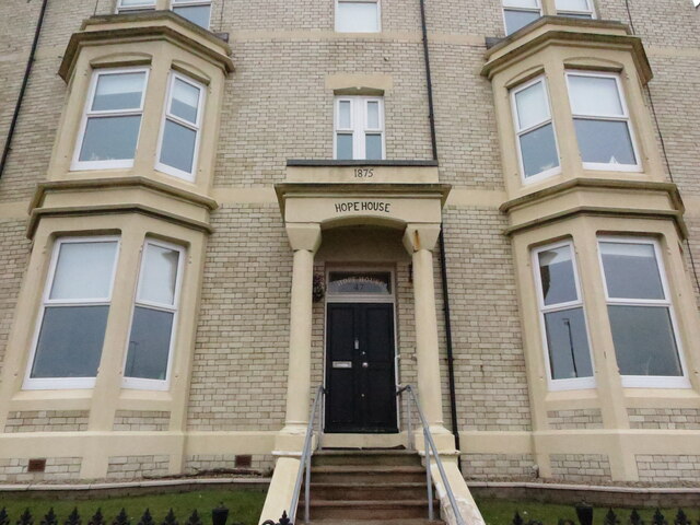
Image: © Geoff Holland Taken: 2 Mar 2021
This double fronted house was built in 1875 as part of the Percy Gardens development https://www.geograph.org.uk/photo/6768929, although this property stands outside of the gated area facing north. During the 1914-18 conflict this property was in the ownership of the War Office, and was used as a command centre for the coastal defences, with an observation and range-finding post built into the roof of the house to control the guns on the River Tyne. In 1916 plans for a six storey tower, attached to the back of the house, were drawn up although the tower was not constructed until the end of the conflict. The tower, known as number 47a Percy Gardens, was used again during the 1939-45 conflict. For a selection of detailed free to download walking routes in the area visit www.northtynesidewalks.co.uk
Images are licensed for reuse under creativecommons.org/licenses/by-sa/2.0
Image Location
Latitude
55.022092
Longitude
-1.423133