Stockwood Free Church
Introduction
The photograph on this page of Stockwood Free Church by Neil Owen as part of the Geograph project.
The Geograph project started in 2005 with the aim of publishing, organising and preserving representative images for every square kilometre of Great Britain, Ireland and the Isle of Man.

There are currently over 7.5m images from over 14,400 individuals and you can help contribute to the project by visiting https://www.geograph.org.uk
Stockwood Free Church
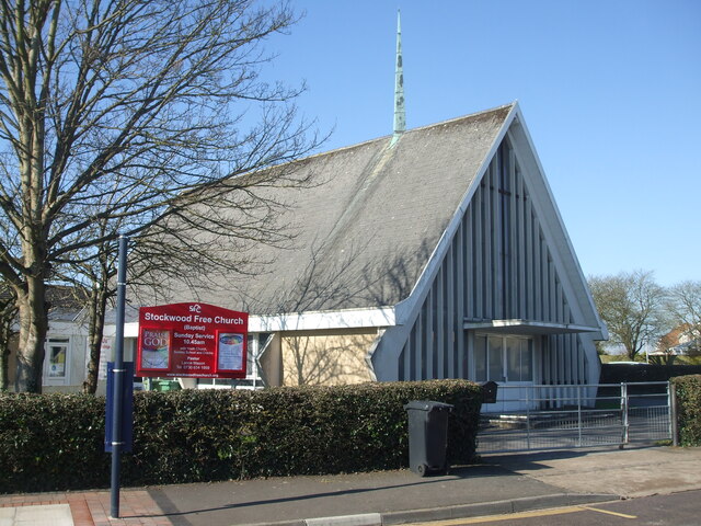
Image: © Neil Owen Taken: 28 Feb 2021
The Baptist church was constructed as the first of the new houses were being built, and was part of the original plans when Stockwood grew up from Sturminster Road. Despite the problems caused in the terrible winter of 1963, the church was completed and a ceremonial opening held on Saturday 7th December that year.
Images are licensed for reuse under creativecommons.org/licenses/by-sa/2.0
Image Location
Latitude
51.412917
Longitude
-2.541457