
Glemsford village sign
Introduction
The photograph on this page of Glemsford village sign by Adrian S Pye as part of the Geograph project.
The Geograph project started in 2005 with the aim of publishing, organising and preserving representative images for every square kilometre of Great Britain, Ireland and the Isle of Man.

There are currently over 7.5m images from over 14,400 individuals and you can help contribute to the project by visiting https://www.geograph.org.uk
Glemsford village sign
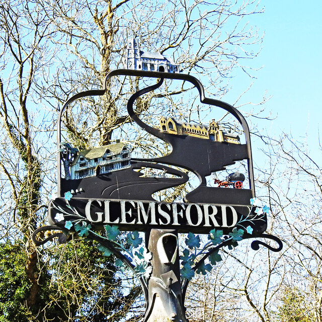
Image: © Adrian S Pye Taken: 26 Feb 2021
The sign is surmounted by the church of St Mary and the long building is the old Board School - now Glemsford Primary Academy. The mediaeval timbered Monks Hall just below left. The horse and cart full of hay represents the farming community and the agricultural heritage of the parish. The group of people in the centre represent the riots which took place in 1885 and caused such havoc that the military had to be called in from Bury St Edmunds to restore order. It was the last time the Riot Act was read out in England. Through the centre of the sign is the winding River Glem, from which Glemsford got its name. The ford is now bridged.
Images are licensed for reuse under creativecommons.org/licenses/by-sa/2.0
Image Location

Latitude
52.100873
Longitude
0.665243