Widewater Lagoon
Introduction
The photograph on this page of Widewater Lagoon by Simon Carey as part of the Geograph project.
The Geograph project started in 2005 with the aim of publishing, organising and preserving representative images for every square kilometre of Great Britain, Ireland and the Isle of Man.

There are currently over 7.5m images from over 14,400 individuals and you can help contribute to the project by visiting https://www.geograph.org.uk
Widewater Lagoon
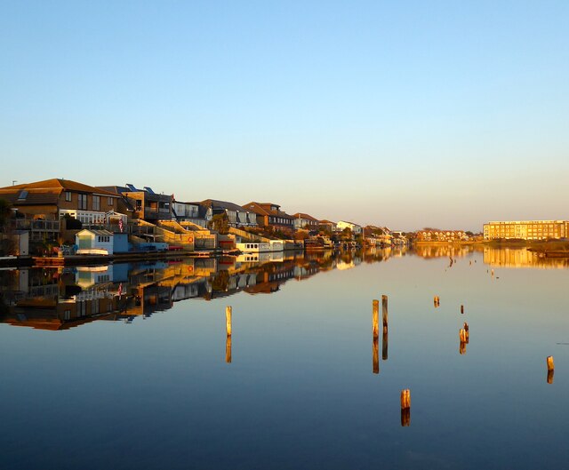
Image: © Simon Carey Taken: 27 Feb 2021
The westward end of the man made lagoon formed in part by the construction of an embankment to protect the Shoreham-Worthing road that is now the A259. Widewater Court is the block of flats at the far end.
Images are licensed for reuse under creativecommons.org/licenses/by-sa/2.0
Image Location
Latitude
50.825926
Longitude
-0.293049