4-6 Clarence Street, Gloucester
Introduction
The photograph on this page of 4-6 Clarence Street, Gloucester by Stephen Richards as part of the Geograph project.
The Geograph project started in 2005 with the aim of publishing, organising and preserving representative images for every square kilometre of Great Britain, Ireland and the Isle of Man.

There are currently over 7.5m images from over 14,400 individuals and you can help contribute to the project by visiting https://www.geograph.org.uk
4-6 Clarence Street, Gloucester
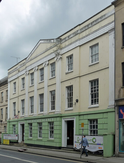
Image: © Stephen Richards Taken: 17 May 2015
Quite stately, dating from the 1830s when the street was cut through by William Rees. Grade II listed. Now offices - the "Estate Agency" seems to be defunct.
Images are licensed for reuse under creativecommons.org/licenses/by-sa/2.0
Image Location
Latitude
51.864199
Longitude
-2.242764