Bath Mews Cottage, Back Front Street, Tynemouth
Introduction
The photograph on this page of Bath Mews Cottage, Back Front Street, Tynemouth by Geoff Holland as part of the Geograph project.
The Geograph project started in 2005 with the aim of publishing, organising and preserving representative images for every square kilometre of Great Britain, Ireland and the Isle of Man.

There are currently over 7.5m images from over 14,400 individuals and you can help contribute to the project by visiting https://www.geograph.org.uk
Bath Mews Cottage, Back Front Street, Tynemouth
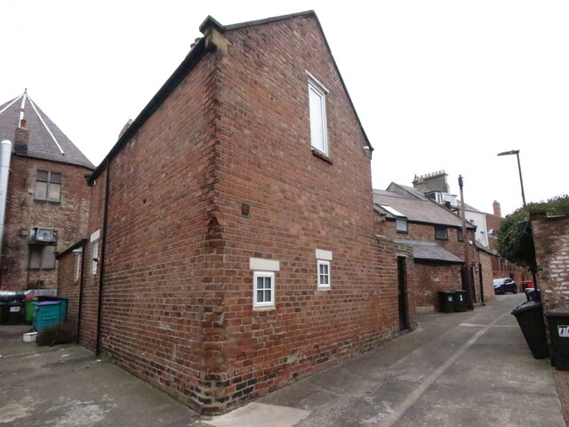
Image: © Geoff Holland Taken: 2 Mar 2021
This two-storey brick-built cottage occupies a triangular site, along with a second cottage, at the back of three neighbouring streets; Front Street, Colbeck Terrace and Bath Terrace. A stone plaque, built into the brickwork, whilst not original, dates the property at "Circa 1870". When the first Ordnance Survey Six-Inch map of the area was published in 1865 (surveyed 1858) these properties had not been built nor indeed had Colbeck Terrace or the south western corner of Front Street. By the time the 1898 edition of the Ordnance Survey map appeared these buildings were in situ although they were not being used as houses. Whilst I am not aware of what Bath Mews Cottage was originally used for, the adjoining cottage was originally a hay loft with stables below, possibly used in conjunction with the Bath Hotel. For a selection of detailed free to download walking routes in the area visit www.northtynesidewalks.co.uk
Images are licensed for reuse under creativecommons.org/licenses/by-sa/2.0
Image Location
Latitude
55.01707
Longitude
-1.425238