The Arcade, Tynemouth
Introduction
The photograph on this page of The Arcade, Tynemouth by Geoff Holland as part of the Geograph project.
The Geograph project started in 2005 with the aim of publishing, organising and preserving representative images for every square kilometre of Great Britain, Ireland and the Isle of Man.

There are currently over 7.5m images from over 14,400 individuals and you can help contribute to the project by visiting https://www.geograph.org.uk
The Arcade, Tynemouth
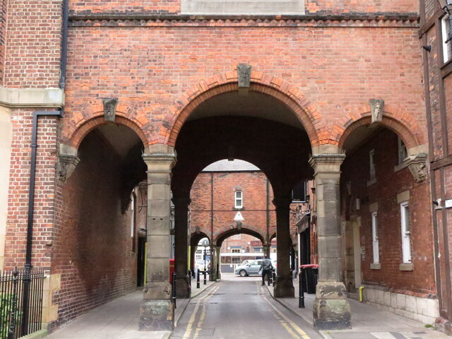
Image: © Geoff Holland Taken: 2 Mar 2021
Built in about 1860 over the passageway between Bath Terrace and Front Street, these four sets of three archways with rooms above were designed to keep carriages sheltered as they arrived at the adjacent Bath Hotel. The elegant shape of the arches is a prominent feature on both Front Street and Bath Terrace. For a selection of detailed free to download walking routes in the area visit www.northtynesidewalks.co.uk
Images are licensed for reuse under creativecommons.org/licenses/by-sa/2.0
Image Location


Leaflet Map data © OpenStreetMap
Latitude
55.016974
Longitude
-1.424145