2 Bath Terrace, Tynemouth
Introduction
The photograph on this page of 2 Bath Terrace, Tynemouth by Geoff Holland as part of the Geograph project.
The Geograph project started in 2005 with the aim of publishing, organising and preserving representative images for every square kilometre of Great Britain, Ireland and the Isle of Man.

There are currently over 7.5m images from over 14,400 individuals and you can help contribute to the project by visiting https://www.geograph.org.uk
2 Bath Terrace, Tynemouth
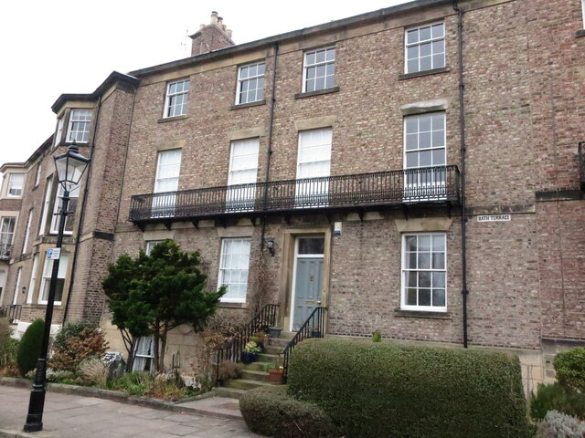
Image: © Geoff Holland Taken: 2 Mar 2021
Along with the adjoining houses (1-11 inclusive), this three-storey four-bay house with basement/lower ground floor, is Grade II Listed. Built in about 1830, the six-panelled front door with overlight in a simple flat architrave, is reached via a flight of stone stairs. There is a cast iron balcony across the full width of the house at first floor level. For a selection of detailed free to download walking routes in the area visit www.northtynesidewalks.co.uk
Images are licensed for reuse under creativecommons.org/licenses/by-sa/2.0
Image Location
Latitude
55.016891
Longitude
-1.425397