Post Box, Highbury, Monkseaton
Introduction
The photograph on this page of Post Box, Highbury, Monkseaton by Geoff Holland as part of the Geograph project.
The Geograph project started in 2005 with the aim of publishing, organising and preserving representative images for every square kilometre of Great Britain, Ireland and the Isle of Man.

There are currently over 7.5m images from over 14,400 individuals and you can help contribute to the project by visiting https://www.geograph.org.uk
Post Box, Highbury, Monkseaton
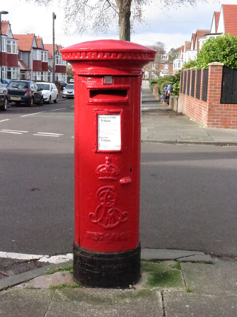
Image: © Geoff Holland Taken: 25 Feb 2021
This post box, which stands at the junction with Windsor Road, dates from the reign of Edward VII (1901-1910). The earliest Edwardian boxes (1901-1904) were modified from the last Victorian boxes but midway through his reign the elaborate scroll cipher began to appear on the post boxes. For a selection of detailed free to download walking routes in the area visit www.northtynesidewalks.co.uk
Images are licensed for reuse under creativecommons.org/licenses/by-sa/2.0
Image Location
Latitude
55.042328
Longitude
-1.466347