Pill Harbour at low tide
Introduction
The photograph on this page of Pill Harbour at low tide by Anthony O'Neil as part of the Geograph project.
The Geograph project started in 2005 with the aim of publishing, organising and preserving representative images for every square kilometre of Great Britain, Ireland and the Isle of Man.

There are currently over 7.5m images from over 14,400 individuals and you can help contribute to the project by visiting https://www.geograph.org.uk
Pill Harbour at low tide
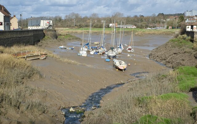
Image: © Anthony O'Neil Taken: 25 Feb 2021
The Avon can have a seven metre rise and fall here. In the 19th century, vessels not wishing to risk the hazardous voyage up river to Bristol moored off Pill and discharged their cargo into small boats for transportation to the port. This provided the village of Pill with a constant demand for marine services and manpower.
Images are licensed for reuse under creativecommons.org/licenses/by-sa/2.0
Image Location
Latitude
51.481494
Longitude
-2.684546