Maybole from Auchenwynd, 2021
Introduction
The photograph on this page of Maybole from Auchenwynd, 2021 by Mary and Angus Hogg as part of the Geograph project.
The Geograph project started in 2005 with the aim of publishing, organising and preserving representative images for every square kilometre of Great Britain, Ireland and the Isle of Man.

There are currently over 7.5m images from over 14,400 individuals and you can help contribute to the project by visiting https://www.geograph.org.uk
Maybole from Auchenwynd, 2021
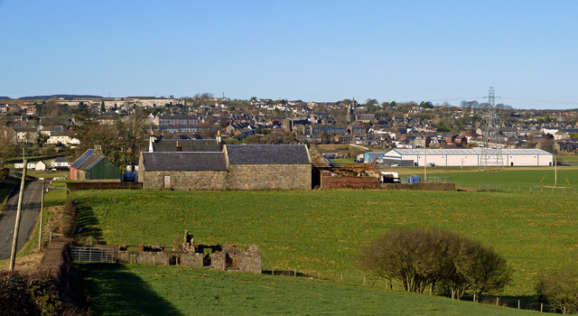
Image: © Mary and Angus Hogg Taken: 22 Feb 2021
This 2021 wide-angle view of Maybole, taken from Auchenwynd Farm, shows the extent of housing on the hillside near Gardenrose Primary School. The factory building on the left is the home of SAS International, a company that supplies the building trade with metal-worked products such as doors and suspended ceilings. The factory was built on the site of the former Ladywell Factory where hard-wearing boots were produced. The trade collapsed in the early 20th century, having made a world-famous Maybole product for many years. For a similar earlier view, see Image
Images are licensed for reuse under creativecommons.org/licenses/by-sa/2.0
Image Location
Latitude
55.343363
Longitude
-4.679156