Old Boundary Marker on Radipole Lane
Introduction
The photograph on this page of Old Boundary Marker on Radipole Lane by D Dougherty as part of the Geograph project.
The Geograph project started in 2005 with the aim of publishing, organising and preserving representative images for every square kilometre of Great Britain, Ireland and the Isle of Man.

There are currently over 7.5m images from over 14,400 individuals and you can help contribute to the project by visiting https://www.geograph.org.uk
Old Boundary Marker on Radipole Lane
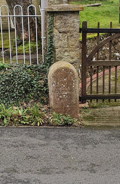
Image: © D Dougherty Taken: 21 Feb 2021
Municipal Boundary Marker in front of the gatepost to the old school on the southeast side of Radipole Lane, opposite St Anne's church. Inscribed BOROUGH/ OF / WEYMOUTH / AND / MELCOMBE / REGIS / 1895 / T H WILLIAMS / MAYOR and marking the boundary of the former municipal borough. Milestone Society National ID: DO_WM14pb
Images are licensed for reuse under creativecommons.org/licenses/by-sa/2.0
Image Location
Latitude
50.630846
Longitude
-2.471777