Corsletts Farm
Introduction
The photograph on this page of Corsletts Farm by Andy Potter as part of the Geograph project.
The Geograph project started in 2005 with the aim of publishing, organising and preserving representative images for every square kilometre of Great Britain, Ireland and the Isle of Man.

There are currently over 7.5m images from over 14,400 individuals and you can help contribute to the project by visiting https://www.geograph.org.uk
Corsletts Farm
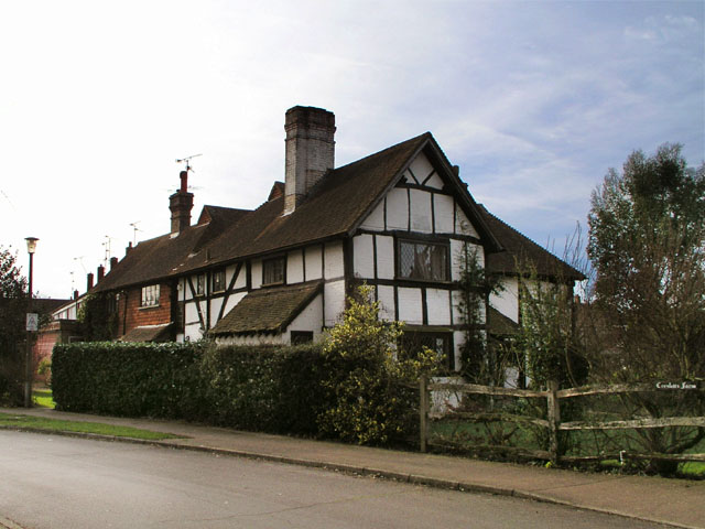
Image: © Andy Potter Taken: 26 Jan 2008
This 14th-century hall house was once the heart of Corsletts Farm. It is now the sole survivor of the farm buildings which went when the farm was developed in the late 1960s. Corsletts Avenue takes its name from the farm.
Images are licensed for reuse under creativecommons.org/licenses/by-sa/2.0
Image Location
Latitude
51.070225
Longitude
-0.362225