Decrepit chapel, Watersfield, 2011
Introduction
The photograph on this page of Decrepit chapel, Watersfield, 2011 by Robin Webster as part of the Geograph project.
The Geograph project started in 2005 with the aim of publishing, organising and preserving representative images for every square kilometre of Great Britain, Ireland and the Isle of Man.

There are currently over 7.5m images from over 14,400 individuals and you can help contribute to the project by visiting https://www.geograph.org.uk
Decrepit chapel, Watersfield, 2011
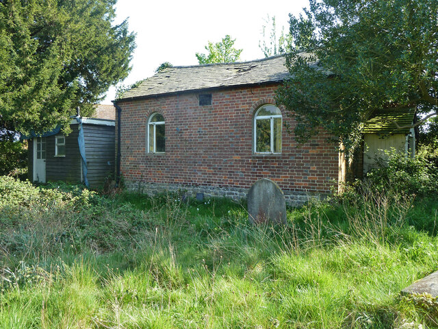
Image: © Robin Webster Taken: 21 Apr 2011
It does not seem to be in use for anything here. Originally an Independent Methodist chapel, then Congregational (if that's different), it has its own little graveyard. Some time after this view it was overhauled and greatly altered notably by raising the height of the walls and roof. It is now advertised on airbnb as a place to stay.
Images are licensed for reuse under creativecommons.org/licenses/by-sa/2.0
Image Location
Latitude
50.932203
Longitude
-0.55813