Delph Locks near Brierley Hill, Dudley
Introduction
The photograph on this page of Delph Locks near Brierley Hill, Dudley by Roger Kidd as part of the Geograph project.
The Geograph project started in 2005 with the aim of publishing, organising and preserving representative images for every square kilometre of Great Britain, Ireland and the Isle of Man.

There are currently over 7.5m images from over 14,400 individuals and you can help contribute to the project by visiting https://www.geograph.org.uk
Delph Locks near Brierley Hill, Dudley
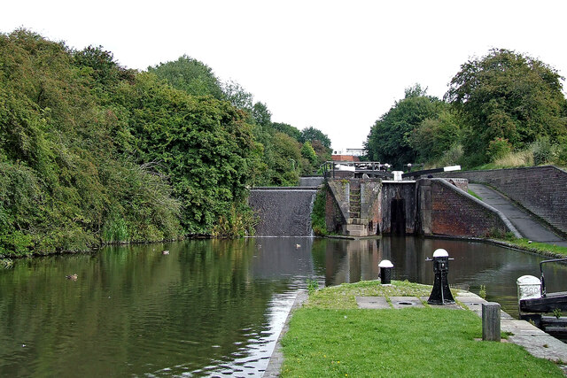
Image: © Roger Kidd Taken: 27 Aug 2010
Looking north-east from Lock No 6, towards Mill Street Bridge and Merry Hill. Locks, stables, Delph Basin Bridge and the lock cottage at the bottom of the flight are all Grade II listed. On the Dudley No 1 Canal, eight locks in the Delph flight provide a fall (or rise) of 85 feet (just under 26 metres) on the Dudley No 1 Canal near Brierley Hill. Originally there were nine locks, opened in 1779, but in the mid 1850s the course was adjusted and the flight rebuilt as eight locks, just the top and bottom ones now being in their original positions. The new flight opened in 1858. There are short wide pounds between each lock and sideponds which help in the water management. On the left by Locks 2 to 7 (as you look north-east), broad weirs by each lock allow surplus water to cascade down into the next pound in the manner of a waterfall. Image]
Images are licensed for reuse under creativecommons.org/licenses/by-sa/2.0
Image Location
Latitude
52.476457
Longitude
-2.12142