Clare features [9]
Introduction
The photograph on this page of Clare features [9] by Michael Dibb as part of the Geograph project.
The Geograph project started in 2005 with the aim of publishing, organising and preserving representative images for every square kilometre of Great Britain, Ireland and the Isle of Man.

There are currently over 7.5m images from over 14,400 individuals and you can help contribute to the project by visiting https://www.geograph.org.uk
Clare features [9]
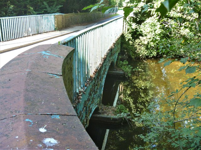
Image: © Michael Dibb Taken: 14 Sep 2020
Ashen Road is carried over the River Stour on this cast iron bridge erected in 1813. This bridge was erected only 34 years after the 1st cast iron bridge to be built at Coalbrookdale. It consists of 3 elliptical arches and the soffits of the arches have cast iron ribs. There is another view of the bridge at Image Listed, grade II, with details at: https://historicengland.org.uk/listing/the-list/list-entry/1194234 The market town of Clare is Suffolk’s smallest town. It lies on the north bank of the River Stour some 12 miles south of Bury St Edmunds and some 7 miles west of Sudbury. Remains of every period since the Palaeolithic have been found in the area. There is a Norman castle, a 13th century Augustinian Priory and a fine, medieval ‘wool’ church as well as many listed buildings, some of which date to the 16th century or earlier.
Images are licensed for reuse under creativecommons.org/licenses/by-sa/2.0
Image Location
Latitude
52.074159
Longitude
0.577766