Old milestone
Introduction
The photograph on this page of Old milestone by Chris Minto as part of the Geograph project.
The Geograph project started in 2005 with the aim of publishing, organising and preserving representative images for every square kilometre of Great Britain, Ireland and the Isle of Man.

There are currently over 7.5m images from over 14,400 individuals and you can help contribute to the project by visiting https://www.geograph.org.uk
Old milestone
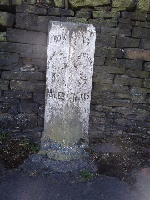
Image: © Chris Minto Taken: 4 May 2017
This is one of 24 surviving stones on roads radiating to the town boundaries that give the distance TO and FROM. These stones were erected at the end of the 19C and were to determine the Cab Fares at a minimum of 1 mile from the Market Cross and then at ½ mile intervals. This stone was in the way when jct 23 of the M62 at Outlane was constructed. Ray Wilson who played in the winning 1966 England football team rescued the stone and kept it in his garden at Barkisland. He gave it to Kirklees Council in 2006 and it was reerected in the cul de sac off New hey Road in 2011/12 near its original site.
Images are licensed for reuse under creativecommons.org/licenses/by-sa/2.0
Image Location
Latitude
53.65904
Longitude
-1.861506