St. James' Church, Southam
Introduction
The photograph on this page of St. James' Church, Southam by Bill Fitchett as part of the Geograph project.
The Geograph project started in 2005 with the aim of publishing, organising and preserving representative images for every square kilometre of Great Britain, Ireland and the Isle of Man.

There are currently over 7.5m images from over 14,400 individuals and you can help contribute to the project by visiting https://www.geograph.org.uk
St. James' Church, Southam
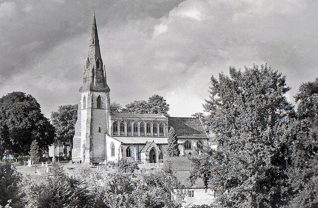
Image: © Bill Fitchett Taken: 17 Jul 1955
This photograph was taken by my father probably in the mid 1950s. The red-brick cottages in the foreground were close to the bridge over the River Stowe at the foot of Warwick Street and have long since been demolished. The rectory is visible behind the church on Park Lane.
Images are licensed for reuse under creativecommons.org/licenses/by-sa/2.0
Image Location


Leaflet Map data © OpenStreetMap
Latitude
52.252526
Longitude
-1.389542