Old milestone
Introduction
The photograph on this page of Old milestone by Chris Minto as part of the Geograph project.
The Geograph project started in 2005 with the aim of publishing, organising and preserving representative images for every square kilometre of Great Britain, Ireland and the Isle of Man.

There are currently over 7.5m images from over 14,400 individuals and you can help contribute to the project by visiting https://www.geograph.org.uk
Old milestone
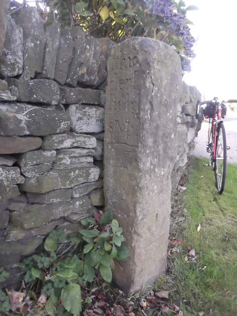
Image: © Chris Minto Taken: 29 Oct 2017
In Upper Cumberworth, on Carr Hill Road at junction with Rowgate. Left face, Hud/derf/field/8 M and hand pointing to right. Front very weathered, not known if there was an inscription although there is a benchmark near the base. ſ used for s. This stone may date from the late 18C.
Images are licensed for reuse under creativecommons.org/licenses/by-sa/2.0
Image Location
Latitude
53.574677
Longitude
-1.689169