Fursdon House
Introduction
The photograph on this page of Fursdon House by Sandy Gerrard as part of the Geograph project.
The Geograph project started in 2005 with the aim of publishing, organising and preserving representative images for every square kilometre of Great Britain, Ireland and the Isle of Man.

There are currently over 7.5m images from over 14,400 individuals and you can help contribute to the project by visiting https://www.geograph.org.uk
Fursdon House
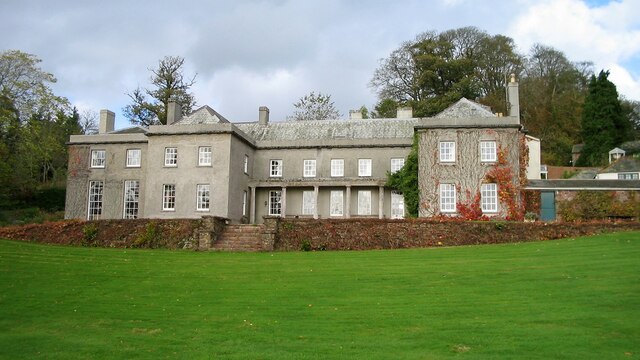
Image: © Sandy Gerrard Taken: 28 Oct 2005
The Fursdon family have lived at this spot since at least 1259. The present house is mainly the result of remodelling in 1732. https://historicengland.org.uk/listing/the-list/list-entry/1253940
Images are licensed for reuse under creativecommons.org/licenses/by-sa/2.0
Image Location
Latitude
50.831213
Longitude
-3.532943