Round Oak Bridge No 2 by the Waterfront Business Park, Dudley
Introduction
The photograph on this page of Round Oak Bridge No 2 by the Waterfront Business Park, Dudley by Roger Kidd as part of the Geograph project.
The Geograph project started in 2005 with the aim of publishing, organising and preserving representative images for every square kilometre of Great Britain, Ireland and the Isle of Man.

There are currently over 7.5m images from over 14,400 individuals and you can help contribute to the project by visiting https://www.geograph.org.uk
Round Oak Bridge No 2 by the Waterfront Business Park, Dudley
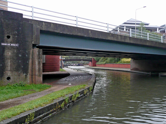
Image: © Roger Kidd Taken: 26 Aug 2010
Looking south-west, the Dudley No 1 Canal is approaching the Waterfront Business Park and Marina, adjacent to the Merry Hill Shopping Centre. The business park was built on the site of the demolished Round Oak Steel works, which closed in 1982. Construction was during 1989 and 1990.
Images are licensed for reuse under creativecommons.org/licenses/by-sa/2.0
Image Location


Leaflet Map data © OpenStreetMap
Latitude
52.48761
Longitude
-2.11556