Eriswell village sign
Introduction
The photograph on this page of Eriswell village sign by Adrian S Pye as part of the Geograph project.
The Geograph project started in 2005 with the aim of publishing, organising and preserving representative images for every square kilometre of Great Britain, Ireland and the Isle of Man.

There are currently over 7.5m images from over 14,400 individuals and you can help contribute to the project by visiting https://www.geograph.org.uk
Eriswell village sign
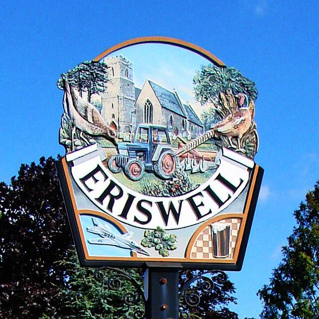
Image: © Adrian S Pye Taken: 12 Feb 2021
The sign has Eriswell church of St Peter as a background to a tractor and plough which symbolises the agricultural heritage of the parish. On the left is a stone curlew with pine trees, and on the right a cock pheasant with wheat, representing the nature of the warrens and heathland to the east. Below the name is a jet aircraft of the USAF representative of neighbouring Lakenheath, a twig of oak leaves and acorns and a glass of beer with a chequered background illustrating the fact The Chequers public house is only a stone’s throw away. https://www.geograph.org.uk/photo/4291926
Images are licensed for reuse under creativecommons.org/licenses/by-sa/2.0
Image Location
Latitude
52.374625
Longitude
0.529293