Direction Sign ? Signpost in Sutton Bonington
Introduction
The photograph on this page of Direction Sign ? Signpost in Sutton Bonington by E Kimberley as part of the Geograph project.
The Geograph project started in 2005 with the aim of publishing, organising and preserving representative images for every square kilometre of Great Britain, Ireland and the Isle of Man.

There are currently over 7.5m images from over 14,400 individuals and you can help contribute to the project by visiting https://www.geograph.org.uk
Direction Sign ? Signpost in Sutton Bonington
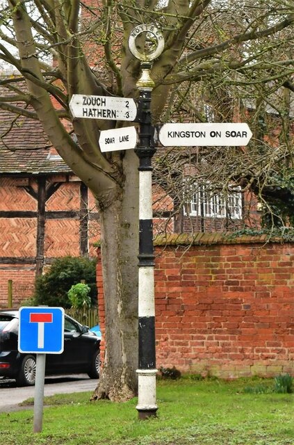
Image: © E Kimberley Taken: 5 Feb 2021
Located on the north side of the T-junction of Soar Lane, Main Street and Marle Pit Hill in Sutton Bonington parish. 3 arms and annulus finial. See also http://www.geograph.org.uk/photo/3987152. Milestone Society National ID: NT_SK5025B
Images are licensed for reuse under creativecommons.org/licenses/by-sa/2.0
Image Location


Leaflet Map data © OpenStreetMap
Latitude
52.825509
Longitude
-1.254923