Cardington and Brown Clee Hill
Introduction
The photograph on this page of Cardington and Brown Clee Hill by Pete Walker as part of the Geograph project.
The Geograph project started in 2005 with the aim of publishing, organising and preserving representative images for every square kilometre of Great Britain, Ireland and the Isle of Man.

There are currently over 7.5m images from over 14,400 individuals and you can help contribute to the project by visiting https://www.geograph.org.uk
Cardington and Brown Clee Hill
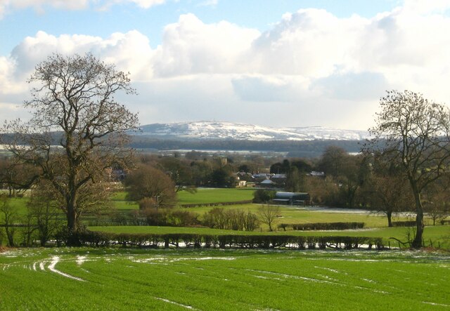
Image: © Pete Walker Taken: 10 Feb 2021
The village of Cardington, with snowy Brown Clee Hill in the distance and the wooded escarpment of Wenlock Edge in the middle distance. Directly behind the church tower is the northern summit of Brown Clee Hill, known as Abdon Burf, at 540m the highest point in Shropshire. Despite being nearly eight miles distant, the church tower at Cardington can be clearly seen from Brown Clee Hill when the sun is shining on the village.
Images are licensed for reuse under creativecommons.org/licenses/by-sa/2.0
Image Location
Latitude
52.552117
Longitude
-2.730441