Old Boundary Marker on the A48 in Pontarddulais
Introduction
The photograph on this page of Old Boundary Marker on the A48 in Pontarddulais by K Hackett as part of the Geograph project.
The Geograph project started in 2005 with the aim of publishing, organising and preserving representative images for every square kilometre of Great Britain, Ireland and the Isle of Man.

There are currently over 7.5m images from over 14,400 individuals and you can help contribute to the project by visiting https://www.geograph.org.uk
Old Boundary Marker on the A48 in Pontarddulais
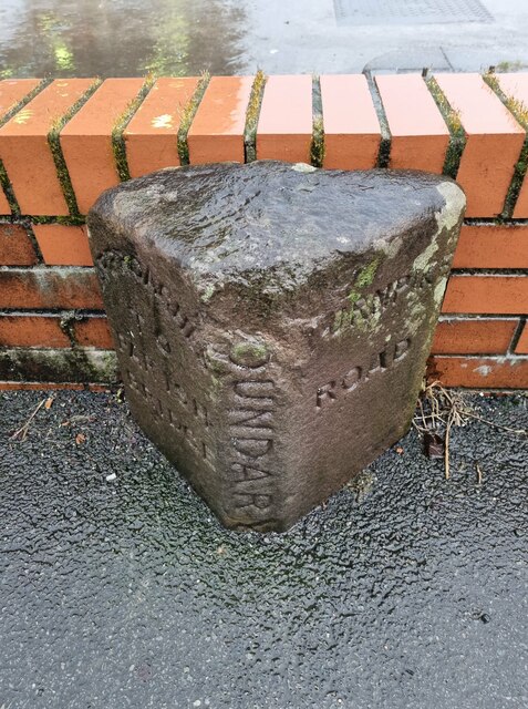
Image: © K Hackett Taken: 6 Feb 2021
Turnpike Bridge Marker against the wall of a filling station on the south side of the A48 St Teilo Street, Pontarddulais. Inscribed APPROACHES / TO / PARISH / BRIDGE on its left face, BOUNDARY vertically on its front face, and TURNPIKE / ROAD on its right face. The stone marks the extent of roadway adjoining the bridge that the parish was obliged to maintain. Milestone Society National ID: GLA_PONT02br
Images are licensed for reuse under creativecommons.org/licenses/by-sa/2.0
Image Location
Latitude
51.715826
Longitude
-4.044738