Morden: Love Lane / Forest Road railway bridge
Introduction
The photograph on this page of Morden: Love Lane / Forest Road railway bridge by Nigel Cox as part of the Geograph project.
The Geograph project started in 2005 with the aim of publishing, organising and preserving representative images for every square kilometre of Great Britain, Ireland and the Isle of Man.

There are currently over 7.5m images from over 14,400 individuals and you can help contribute to the project by visiting https://www.geograph.org.uk
Morden: Love Lane / Forest Road railway bridge
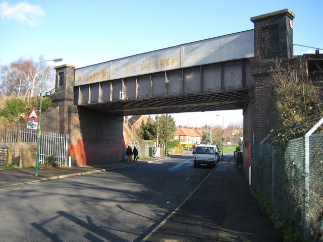
Image: © Nigel Cox Taken: 30 Jan 2008
The bridge carries the railway line between Sutton Common and St Helier stations over Love Lane / Forest Road here. The road name changes at the bridge, and the photographer is standing on the Forest Road side. The boundary between the London Boroughs of Merton (to the left) and Sutton (to the right) runs down the road through the bridge. The two white posts by the bridge abutments are boundary markers for the former local government arrangements. The post on the left demarcates the boundary between the former Municipal Boroughs of Sutton & Cheam to the left and Merton & Morden to the right including the bridge, while the one on the right indicates the boundary between Carshalton and Sutton & Cheam again. Resurfacing work and subsidence around the first post has resulted in the loss of the letter M in Merton so the post actually reads "ERTON & MORDEN"! This is the same viewpoint as Noel's Image from July 2005. The only apparent changes are that the graffiti on the bridge has thankfully been painted over and the circular plate at the bridge soffit, possibly a height warning sign, has disappeared.
Images are licensed for reuse under creativecommons.org/licenses/by-sa/2.0
Image Location
Latitude
51.384624
Longitude
-0.200774