
A Perfect Bridge
Introduction
The photograph on this page of A Perfect Bridge by Ian Dodds as part of the Geograph project.
The Geograph project started in 2005 with the aim of publishing, organising and preserving representative images for every square kilometre of Great Britain, Ireland and the Isle of Man.

There are currently over 7.5m images from over 14,400 individuals and you can help contribute to the project by visiting https://www.geograph.org.uk
A Perfect Bridge
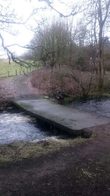
Image: © Ian Dodds Taken: 6 Feb 2021
An unexpected concrete bridge that doesn't currently lead to anywhere on the camera side of the Murieston Water burn. It isn't shown on any of the last available free online maps from the mid 20th century, and it isn't obvious why it was built as there are other adequate road bridges nearby in both directions. It is perfect because : 1) There are no railings, so you have the feeling of being in the middle of the water. 2) It is extremely sturdy, so no chance of slipping and falling in! 3) It is also extremely wide (about 10 feet), so again no chance of falling in, despite the lack of walls or railings. 4) Unlike most bridges it pretty much sits on top of the water - you are only a few inches above the water when it is in full spate.
Images are licensed for reuse under creativecommons.org/licenses/by-sa/2.0
Image Location

Latitude
55.856238
Longitude
-3.515991