The entrance to Tanners' Yard
Introduction
The photograph on this page of The entrance to Tanners' Yard by Mike Quinn as part of the Geograph project.
The Geograph project started in 2005 with the aim of publishing, organising and preserving representative images for every square kilometre of Great Britain, Ireland and the Isle of Man.

There are currently over 7.5m images from over 14,400 individuals and you can help contribute to the project by visiting https://www.geograph.org.uk
The entrance to Tanners' Yard
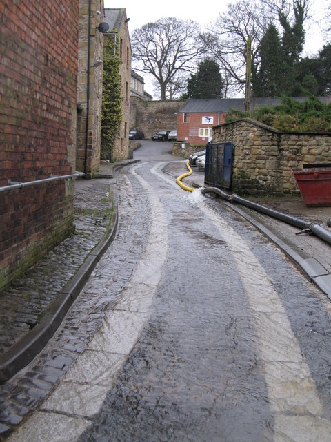
Image: © Mike Quinn Taken: 1 Feb 2008
From time immemorial, Cowgarth Burn has flowed along this entrance to Tanners' Yard. During 2007, flood relief works were carried out in this general area. But in early February 2008, splits in the joins of the temporary piping resulted in the burn again flowing down the carriageway. See Image
Images are licensed for reuse under creativecommons.org/licenses/by-sa/2.0
Image Location
Latitude
54.97291
Longitude
-2.104947