How the Heart Loch got its name
Introduction
The photograph on this page of How the Heart Loch got its name by Mary and Angus Hogg as part of the Geograph project.
The Geograph project started in 2005 with the aim of publishing, organising and preserving representative images for every square kilometre of Great Britain, Ireland and the Isle of Man.

There are currently over 7.5m images from over 14,400 individuals and you can help contribute to the project by visiting https://www.geograph.org.uk
How the Heart Loch got its name
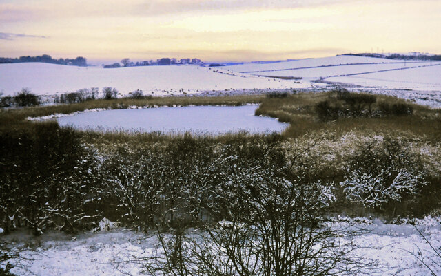
Image: © Mary and Angus Hogg Taken: Unknown
This 1979 snow scene shows how the Heart Loch got its name. A small floating island of reeds was able to move across the surface but usually was in the position shown here, creating the heart shape. Image also shows the outline.
Images are licensed for reuse under creativecommons.org/licenses/by-sa/2.0
Image Location
Latitude
55.349763
Longitude
-4.666021