Heart Loch view 1975
Introduction
The photograph on this page of Heart Loch view 1975 by Mary and Angus Hogg as part of the Geograph project.
The Geograph project started in 2005 with the aim of publishing, organising and preserving representative images for every square kilometre of Great Britain, Ireland and the Isle of Man.

There are currently over 7.5m images from over 14,400 individuals and you can help contribute to the project by visiting https://www.geograph.org.uk
Heart Loch view 1975
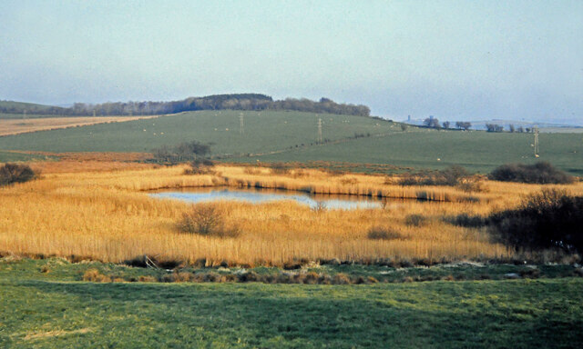
Image: © Mary and Angus Hogg Taken: Unknown
This 1975 view shows the heart-shaped outline of this little loch near Maybole which was left by the receding ice towards the end of the last glaciation. Fire damage to the reed bed in 2001 removed the heart shape Image
Images are licensed for reuse under creativecommons.org/licenses/by-sa/2.0
Image Location
Latitude
55.349674
Longitude
-4.666015