Old Boundary Marker on the A362 in Frome
Introduction
The photograph on this page of Old Boundary Marker on the A362 in Frome by J Dowding as part of the Geograph project.
The Geograph project started in 2005 with the aim of publishing, organising and preserving representative images for every square kilometre of Great Britain, Ireland and the Isle of Man.

There are currently over 7.5m images from over 14,400 individuals and you can help contribute to the project by visiting https://www.geograph.org.uk
Old Boundary Marker on the A362 in Frome
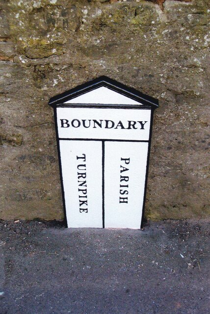
Image: © J Dowding Taken: 2 Mar 2009
Turnpike Terminus Marker on the pavement against a stone wall on the south side of the A362 Christchurch Street. FROME parish. In raised lettering TURNPIKE and PARISH both vertically with PARISH horizontally above both. Repainted by The Milestone Society in February 2009. Grade II Listed https://historicengland.org.uk/listing/the-list/list-entry/1172925. See also https://www.geograph.org.uk/photo/6459333 and https://www.geograph.org.uk/photo/3976207. Milestone Society National ID: SO_FR02t
Images are licensed for reuse under creativecommons.org/licenses/by-sa/2.0
Image Location
Latitude
51.228485
Longitude
-2.319256