St Austell railway viaduct
Introduction
The photograph on this page of St Austell railway viaduct by Crispin Purdye as part of the Geograph project.
The Geograph project started in 2005 with the aim of publishing, organising and preserving representative images for every square kilometre of Great Britain, Ireland and the Isle of Man.

There are currently over 7.5m images from over 14,400 individuals and you can help contribute to the project by visiting https://www.geograph.org.uk
St Austell railway viaduct
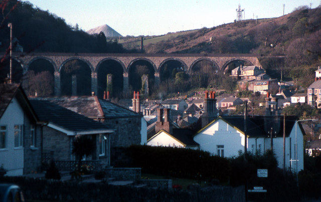
Image: © Crispin Purdye Taken: Unknown
View from the south of the viaduct that carries the mainline Cornish railway. Trademark St Austell area clay tip and engine house chimney in the centre background. photograph taken in 1979
Images are licensed for reuse under creativecommons.org/licenses/by-sa/2.0
Image Location
Latitude
50.34142
Longitude
-4.798059