Pont Spwdwr
Introduction
The photograph on this page of Pont Spwdwr by Alan Richards as part of the Geograph project.
The Geograph project started in 2005 with the aim of publishing, organising and preserving representative images for every square kilometre of Great Britain, Ireland and the Isle of Man.

There are currently over 7.5m images from over 14,400 individuals and you can help contribute to the project by visiting https://www.geograph.org.uk
Pont Spwdwr
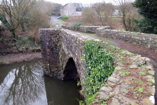
Image: © Alan Richards Taken: 1 Feb 2021
Adeiladwyd Pont Spwdwr, sy'n rhychwantu Afon Gwendraeth Fawr, yn ystod ail hanner yr 16g ac mae hi bellach yn hygyrch i gerddwyr a beicwyr yw'r unig. Arferai'r anhedd-dy yn y pellter fod yn dafarn o'r enw Spudder Bridge. Pont Spwdwr, which spans Afon Gwendraeth Fawr, was built in the second half of the sixteenth century and is only accessible today to walkers and cyclists. The property in the distance is a former public house known as Spudder Bridge.
Images are licensed for reuse under creativecommons.org/licenses/by-sa/2.0
Image Location
Latitude
51.729795
Longitude
-4.268818