The 'Lost' River Wogebourne
Introduction
The photograph on this page of The 'Lost' River Wogebourne by Marathon as part of the Geograph project.
The Geograph project started in 2005 with the aim of publishing, organising and preserving representative images for every square kilometre of Great Britain, Ireland and the Isle of Man.

There are currently over 7.5m images from over 14,400 individuals and you can help contribute to the project by visiting https://www.geograph.org.uk
The 'Lost' River Wogebourne
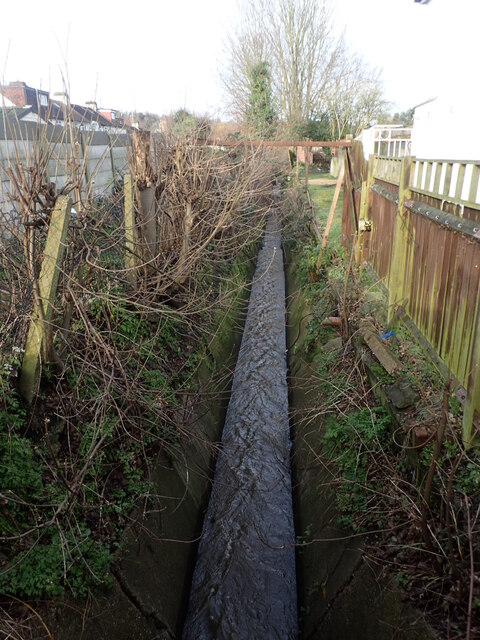
Image: © Marathon Taken: 31 Jan 2021
The River Wogebourne rose on the slopes of Shooters Hill, ran across what is now Woodlands Farm and East Wickham Open Space before turning north along the Wickham Valley. It is seen here flowing downstream from Streamway. Not only the river lives on but in the road names of Streamway, Woodbrook Road, Bournewood Road and Waterdale Road, all in this small area. A full history of the Wogebourne can be seen at http://e-shootershill.co.uk/2013/09/08/wogebourne/
Images are licensed for reuse under creativecommons.org/licenses/by-sa/2.0
Image Location
Latitude
51.478396
Longitude
0.108075