Old Milestone, on the A629, ? mile W of Chapeltown centre
Introduction
The photograph on this page of Old Milestone, on the A629, ? mile W of Chapeltown centre by Christine Minto as part of the Geograph project.
The Geograph project started in 2005 with the aim of publishing, organising and preserving representative images for every square kilometre of Great Britain, Ireland and the Isle of Man.

There are currently over 7.5m images from over 14,400 individuals and you can help contribute to the project by visiting https://www.geograph.org.uk
Old Milestone, on the A629, ? mile W of Chapeltown centre
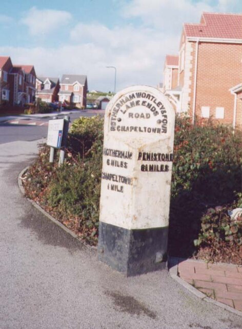
Image: © Christine Minto Taken: Unknown
On Burncross Road. Located on the North side of road, at entrance to Burncross Drive. Metal plate attached to stone post, Brayshaw & Booth casting design, 19th century. More recently a low, faux limestone wall has been built behind the milestone. View before the housing estate was built see http://www.geograph.org.uk/photo/6742561 Inscription reads: ROTHERHAM / 6 MILES / CHAPELTOWN / ½ MILE // PENISTONE / 8¼ MILES // ROTHERHAM WORTLEY & FOUR / LANE ENDS / ROAD / CHAPELTOWN // BRAYSHAW & BOOTH / MAKERS / LIVERSEDGE Grade II listed by Historic England. see https://historicengland.org.uk/listing/the-list/list-entry/1132828 Milestone Society National ID: YS_RMWT06
Images are licensed for reuse under creativecommons.org/licenses/by-sa/2.0
Image Location
Latitude
53.461856
Longitude
-1.479972