Long Melford houses [71]
Introduction
The photograph on this page of Long Melford houses [71] by Michael Dibb as part of the Geograph project.
The Geograph project started in 2005 with the aim of publishing, organising and preserving representative images for every square kilometre of Great Britain, Ireland and the Isle of Man.

There are currently over 7.5m images from over 14,400 individuals and you can help contribute to the project by visiting https://www.geograph.org.uk
Long Melford houses [71]
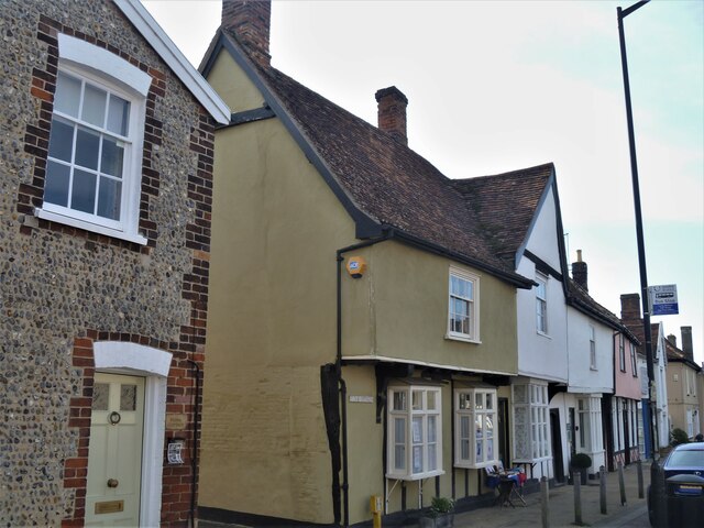
Image: © Michael Dibb Taken: 13 Sep 2020
Number 1, 2 and 3 Tudor Cottages in Hall Street occupy what is probably a 16th or 17th timber framed and stuccoed house. There is a crosswing to the left which appears to be a central gable as an extension was added beyond the crosswing. The property is jettied to the street but on different levels. Number 2 has an original boarded entrance door. Listed, grade II, with details at: https://historicengland.org.uk/listing/the-list/list-entry/1284438 Long Melford is a large village in Suffolk near the border with Essex, some 3 miles north of Sudbury. The village gained its name because it stretches for two and three quarter miles essentially along a single road. There is evidence of occupation from every period from the Mesolithic. The village contains two stately homes, Kentwell Hall and Melford Hall, is home to one of the largest and richest "wool churches" in East Anglia with fine flushwork, and a superb almshouse founded in 1573.
Images are licensed for reuse under creativecommons.org/licenses/by-sa/2.0
Image Location
Latitude
52.077584
Longitude
0.717493